Fall 2018 Travel Guide (Ireland, Georgia, Armenia)

Visiting the Opposite Corners of Europe

P_20180918_123656_vHDR_Auto.jpg

What does Europe’s Northwestern most country (excluding Iceland) have in common with the two Caucasus countries of Georgia and Armenia? Well, they each have between 3-5 million people, declared independence from empires (British, Russian, and Ottoman) in 1916 and 1917, and have an abundance of sheep. Oh yeah, I also visited all three this fall. Here is my guide to what I did in each of them, now conveniently organized for you, my readers.

Country Profiles

IRELAND

IRELAND

GEORGIA

GEORGIA

ARMENIA

ARMENIA

Adventurous Moments

Scenes from an Armenian Road Trip

Scenes from an Armenian Road Trip

Cheating Death on the Road to Tusheti

Cheating Death on the Road to Tusheti

New Places Seen

TUSHETI, GEORGIA

TUSHETI, GEORGIA

NEWGRANGE, IRELAND

NEWGRANGE, IRELAND

LAKE SEVAN, ARMENIA

LAKE SEVAN, ARMENIA

LAGODEKHI, GEORGIA

LAGODEKHI, GEORGIA

DINGLE, IRELAND

DINGLE, IRELAND

CORK, IRELAND

CORK, IRELAND

SVANETI, GEORGIA

SVANETI, GEORGIA

GRAPEVINE HOSTEL

GRAPEVINE HOSTEL

Photo Albums

GLORIOUS KAZBEGI

GLORIOUS KAZBEGI

TUSHETI

TUSHETI

ARMENIAN LANDSCAPES

ARMENIAN LANDSCAPES

DINGLE PENINSULA

DINGLE PENINSULA

Tusheti: Outside of Time

Accessible only by a narrow dirt road with a 3000m (2 mile) overpass is the Georgian region of Tusheti. Due to the remoteness of the location, there are only seven villages, a few ancient fortresses to protect from medieval raids, and less that 50 residents that stay through the winter. Most of the locals make a living through shepherding, and selling wine to the few crazy backpackers who make their way up there for hiking and camping. Naturally, I was one of those backpackers.

P_20180918_143709_vHDR_Auto.jpg

The Journey

The Road

The Road

At the 3000m overpass

At the 3000m overpass

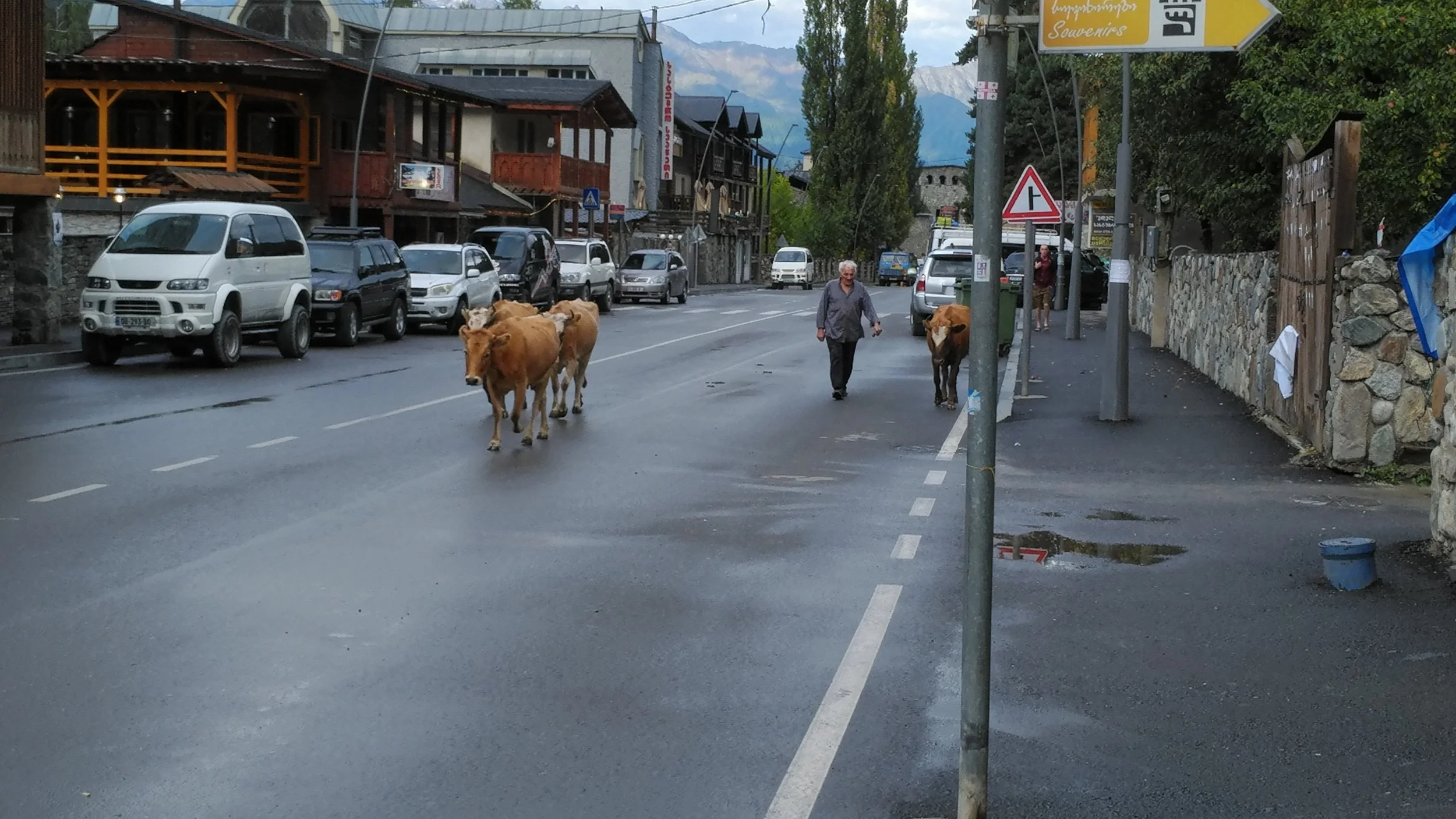
This is just the info. For the full retelling of how my personal journey to Tusheti went, please click the link below for my full illustrated story. This is for information. The most common way people get to Tusheti is by going from either Tbilisi or Telavi to Kvermo Alvani and then hiring a driver to take you to Omalo. Here are the steps:

  • Tbilisi - Kvermo Alvani: 2 hours, 15 lari per person / taxi)

  • Telavi - Kvermo Alvani: 20 minutes (2 lari per person / marshrutka)

  • Kvermo Alvani - Omalo: 4-10 hours (50 lari per person / 4x4)

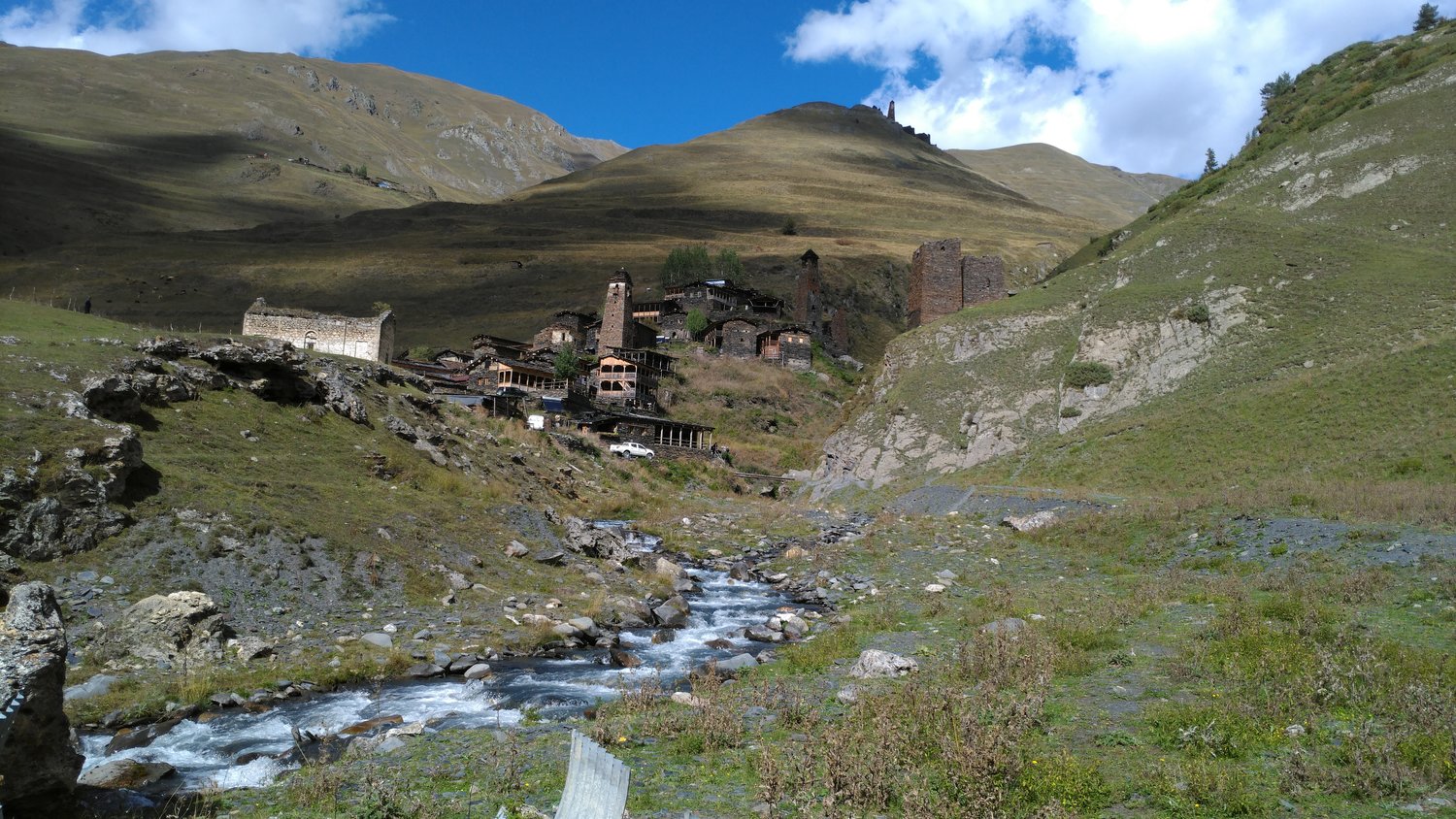
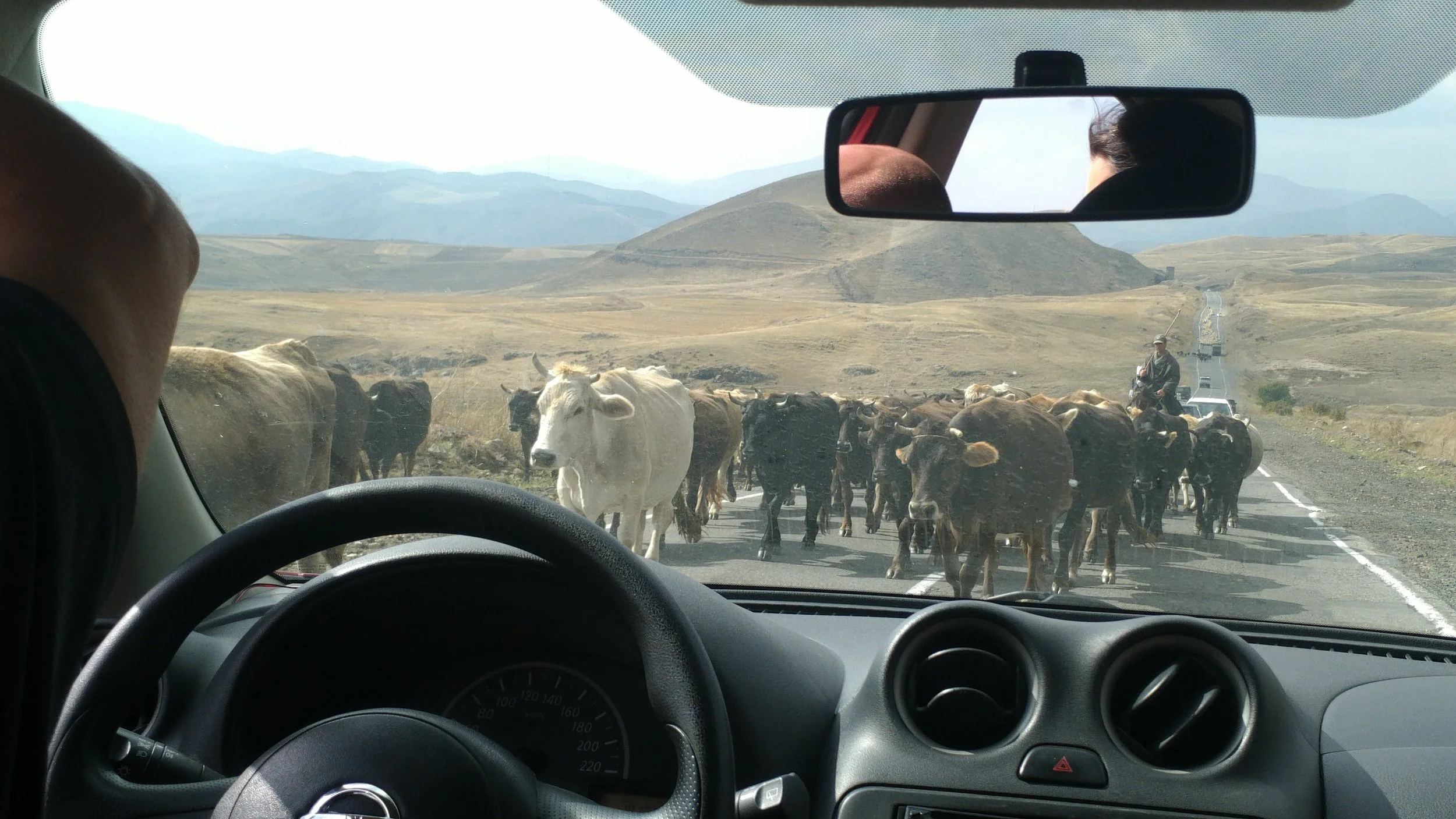
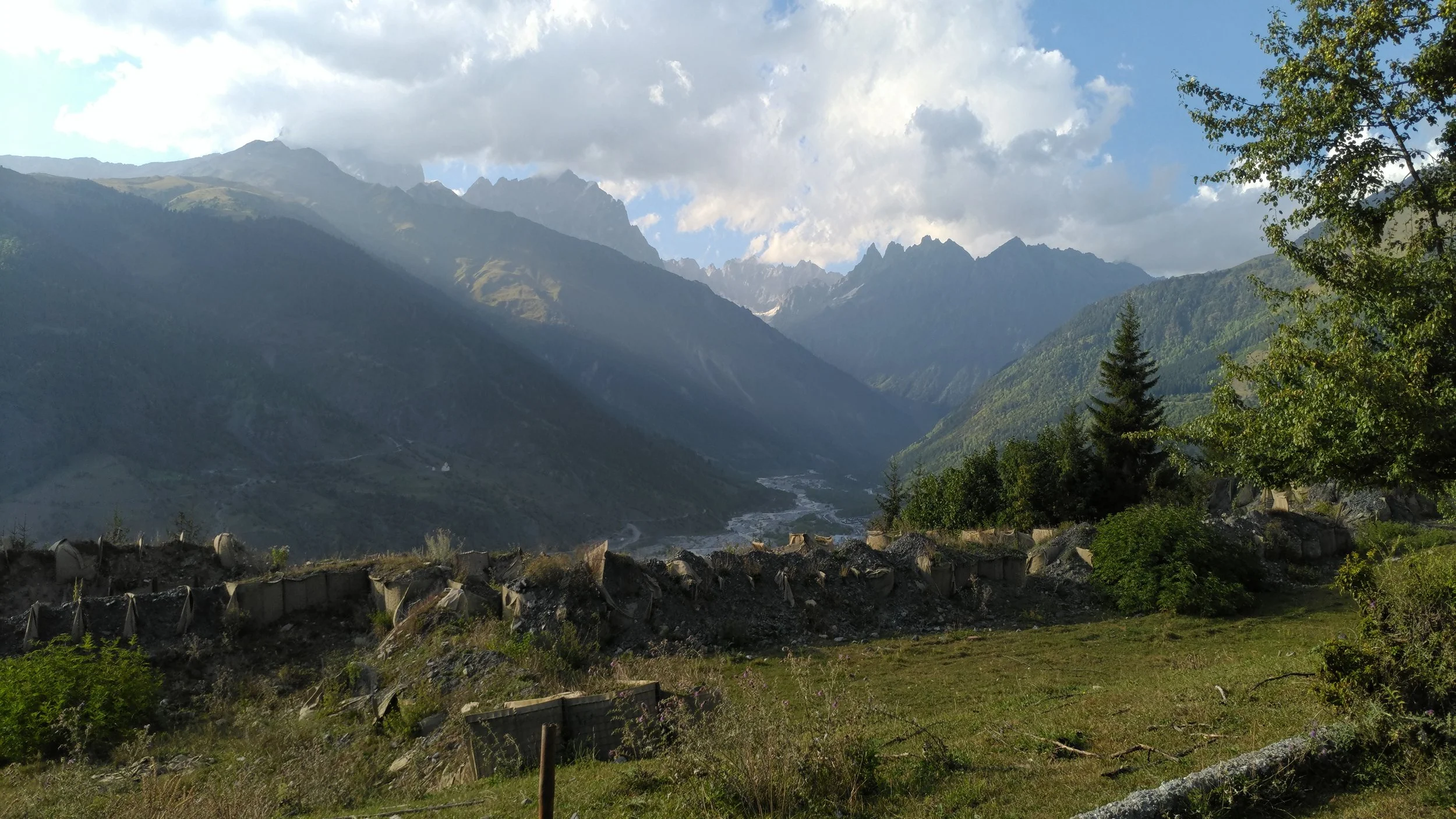
The journey as a whole from the town Kvermo Alvani can take anywhere from 4.5 to 10 hours depending on how frequently your group stops. Since we stopped for waterfalls, a ‘quick’ break at a hot spring, and to have long conversations with various tomato salesmen, ours took 10. Although the distance is not far, the road itself is what makes the journey difficult. Considered be one of the most dangerous in the world, the road to Tusheti is not conducive to vehicles, human legs, or pretty much anything living for that matter. Barely wide enough for just one car, it snakes up the side of a huge mountain with absolutely no guard rails, offering a variety of views of spectacular landscapes, amazing waterfalls, and cliffs you could easily plummet off of. It a mix of stunning beauty and terrifying deadliness, sort of like female villains in James Bond movies.

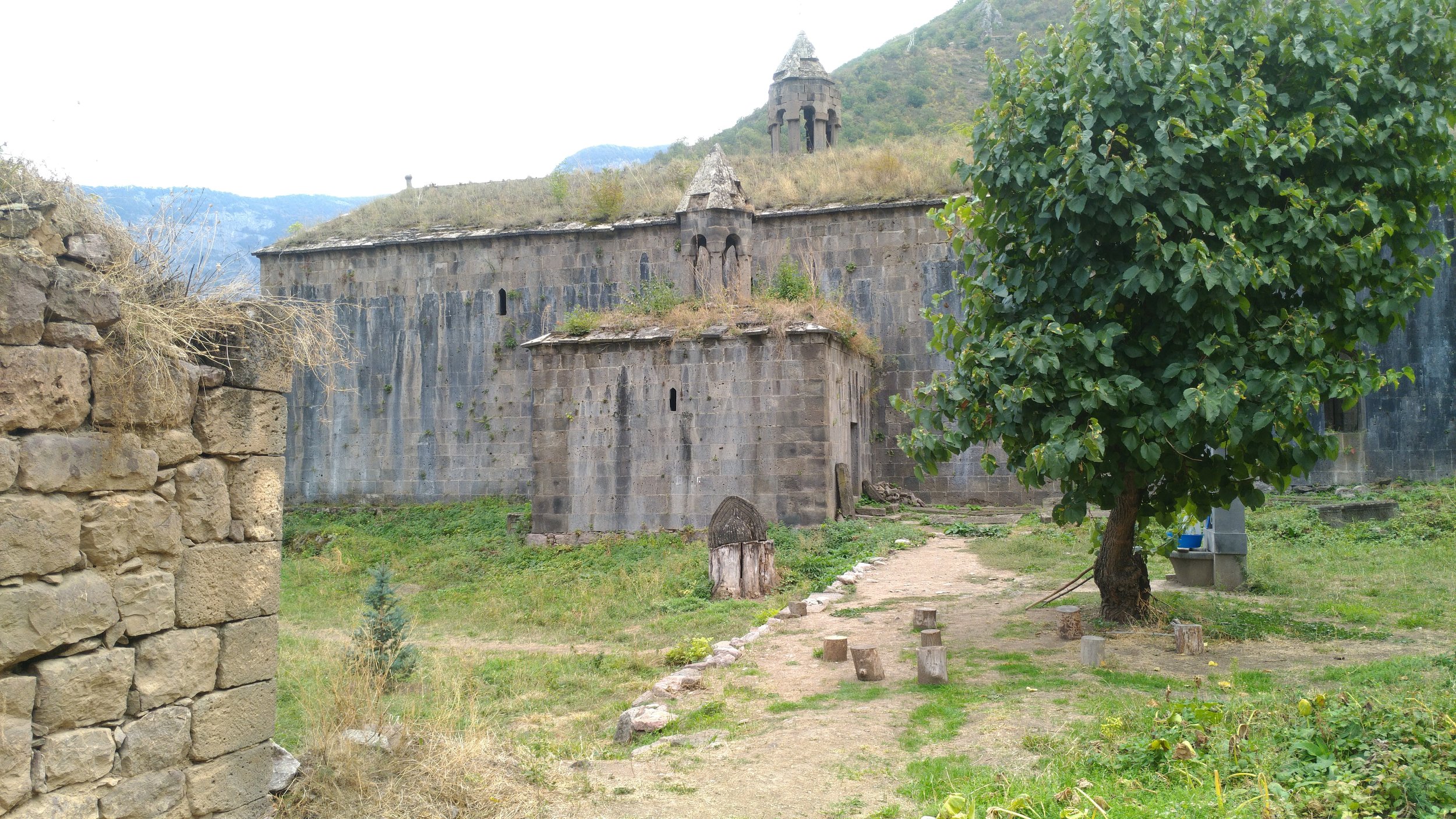
However, you’ll be brought back to reality on the way up as there are several grave sites on the way up of. Our group (upon our driver’s request), stopped at one of these sites, which he said belonged to his friends. It was just short of the top, and upon exiting the vehicle, he drew out a bottle of vodka and some food. We were to drink to their memory, as they would have wanted. A few of us objected at first, but the driver said that the less we drink, the more there would be for him to drink. Therefore, we all agreed to partake. I would tell you more, but since this is meant to be a ‘how to’ informational post, I’ll direct you to this illustrated story I wrote about it. Spoiler alert, we lived and made it to Tusheti.

DSCN6191.JPG
DSCN6193.JPG

Nature and Hikes

I’ll be direct, this is the reason I came to Tusheti. While Georgia has other notable places for trekking (such as Svaneti and Kazbegi), Tusheti is by far the wildest and most untouched. As a result, the trails are far more rugged and the amount of people you’ll see along the way, if any, is far fewer. It doesn’t really matter which route you take or which direction you head in, literally every landscape will absolutely blow your mind. Everything seems so untouched and removed from the rest of society, and there were no awful tourists waving those metallic abominations known as selfie sticks. Instead, there was the rugged countryside, herds of sheep, and occasional old ruins.

While I was there, I did three hikes and can recommend each one of them. The first I did was from a village called Darklo to Omalo (where I was staying). The day started off as a jeep trip around the region, but after our driver got fairly intoxicated en route, I opted to use my good old-fashioned legs and walk. The whole journey was about 14km and took 3-4 hours. Most of the trail was pretty easy to follow. It started out relatively flat, but as it went on, there were several long and steep uphills and downhills. I, personally, found the ending to be pretty interesting, because before you get to the more prominent Lower Omalo, you have to pass the ruins of Upper Omalo. Upper Omalo consists of a few small houses and old guard towers. Some of which are in ruins and others have been restored. It makes for an interesting stopping point, but the views you get of the town and valley below are pretty amazing.

Darklo to Omalo trail

Darklo to Omalo trail

Darklo in the distance

Darklo in the distance

The second one I did was from Omalo to Diklo and Diklo fortress. Initially, the plan was to go all the way back to Omalo, but as night was setting in, my friends and I had to hitch a ride from a local in the town to get back. Personally, I couldn’t recommend this one enough. The way there begins on a dirt road, but once you reach the village Shenako you have the option of splitting off and taking a trail through mountainous woods. And although that option is longer and more difficult, the views are incredible and there was no sign whatsoever of other human beings. If you take the road, the journey is about 4 hours to Diklo and on the trail it’s about 5. If you decide to go on to the fortress (as you should), it’s another half hour or so from the town.

P_20180919_152618_vHDR_Auto.jpg
P_20180919_160153_vHDR_Auto.jpg

The third was up to a lake that was on the way up Mt. Encho. For this one, I began in Omalo by taking the main road down into a valley below. From there, I took a path that crossed a field and went into the woods. The path itself is pretty steep, but once you get to the clearing, you’ll realize that all the incline was worth it. Your entire view of the landscape will oped up and reveal endless hills and mountains of the remote countryside. My friends got lucky on this particular hike and ended up with an unexpected companion. Right at the beginning of their trek, a young dog joined them, going all the way up the mountain, back down, and ultimately to our guesthouse in Omalo. So anyway, I encourage you, my readers, to do the same. And who knows, you may find our dog friend on the way.

P_20180920_165524_vHDR_Auto.jpg

The Villages

In the whole, vast region, there are just seven villages spread out over Tusheti. There is a small network of dirt roads and trails connecting them, and during my visit I saw four of them (therefore I’ll just write about those for now). The most prominent of these, and the one in which my group stayed, is Omalo. Out of all these, Omalo has the greatest availability of guesthouses and will be the first one you approach upon arriving to Tusheti. That’s where I’ll begin.

OMALO

Omalo at dusk

Omalo at dusk

Restored guard towers in Upper Omalo

Restored guard towers in Upper Omalo

Most likely, if you come to Tusheti, you’ll spend at least your first night in Omalo. And if you do, I highly recommend staying at Guesthouse Tishi (which is where I stayed). The lady who runs the place is incredibly nice, the house is spacious and comfortable, and the food she makes is delicious (even though the bread is sometimes a bit stale). Omalo is the perfect starting point for most of the treks in Tusheti as well, and is the easiest to find by road (in case you’re running late and need to hitch a ride before dark). Out of all the villages, Omalo definitely has the best availability of guesthouses and even contains a few small shops to buy snacks or wool products. It’s a good and (compared to the rest of the villages) easier place to make your home-base while staying in the region. There’s also a small information center in the town which, although small, is a nice place to visit if you want to learn about the area or plan a few hikes.

DIKLO

All of Diklo

All of Diklo

View from the ancient ruins of Diklo Fortress

View from the ancient ruins of Diklo Fortress

Of all the other towns in the region, I highly recommend hiking to Diklo. As stated above, I hiked there on one of the treks, and if I had anything with my (such as a wallet to pay for a room), there is a good chance I would have stayed there for the night. But I didn’t, so I couldn’t. Anyway though, the town itself is on the side of a hill and consists of a few houses. Some of them also serve as guest houses while others sell handmade wool products, snacks, and alcohol. There are two possible ways to reach Diklo, the first is by road and the second by trail. If you go by trail (as I did), it will take longer but the views will be nicer. Plus, you will come upon the town right after exiting a forest, which is a pretty nice introduction to the place.

DARTLO

Guesthouse in Dartlo with really good Hachapuri.

Guesthouse in Dartlo with really good Hachapuri.

The horror, the horror

The horror, the horror

On my second day in Tusheti, my friends and I hired a driver to take us to different places in the region. The final one I made it to (before I opted to start hiking instead) was a small village in a valley known as Dartlo. The town itself is on the side of a hill overlooking a small stream and is comprised of a few stone buildings. Although we didn’t spend much time there overall, my friends and I stopped for lunch at one of the guest houses and were treated to coffee and possibly the best hachapuri I had while in Georgia. It’s a really nice and scenic place and contains a couple guesthouses, plus it isn’t too far from Omalo. It is definitely worth the visit if you get the chance (even if just for the walk in the valley).

BORCHONA

P_20180918_114324_vHDR_Auto.jpg

Although most people credit the town Ushguli as the highest village in both Georgia and Europe, that title actually (as of 2014) belongs to Borchona. The village itself is 100m higher than Ushguli, but in order to be officially recognized in the sensus, there needed to be at least one permanent resident. For decades, there was not, but in 2014, one guy decided to stay throughout the winter and has been there ever since. Now, the village has an official population of one and is the highest inhabited place in all of Europe. Make sure you go visit, even if just for the novelty of it.

SHENAKO

While I didn’t spend much time here, Shenako is a cozy little village about half way between Omalo and Diklo. There are a couple of guesthouses if you feel like stopping for the night, but my group and I just sat on the side of a hill and had a snack and coffee before continuing through. If you are going on to Diklo from here, you have the choice of taking a road path or a trail through mountainous woods.

Small guesthouse in a village

Small guesthouse in a village

Guesthouse

For my stay, I spent four nights at Guesthouse Tishi in Omalo, and I can highly recommend it to anyone going to Tusheti. The place itself was really comfortable and pretty spacious, and the hostess was incredibly nice. She was always happy, smiling, and there to help us with anything we needed. Every morning, she cooked breakfast and made tea for everyone, and every evening, she made a large, hearty dinner. On to of that, she has a shop where you can buy snacks and wine as well as handmade wool products. It was a great place and when I go back, I’m sure to stay there. You, my readers, should too.

Costs at Tishi Guesthouse:

  • 1 Night (breakfast and dinner included): 50 lari

  • Turkish Coffee: 3 lari

  • 1 liter of wine: 5 lari

  • Jar of penuts: 3 lari

  • Sweet Snacks: 3-5 lari

Scenes from an Armenian Roadtrip

A Two-Day Drive Around the Country

Just little local traffic

Just little local traffic

I recently returned to the country Armenia with the intention of seeing much more of the country than I did during my previous trip. However, there was a slight problem with my plan: historical sites were many but my time was limited. What was I to do? Alongside two friends, Teresa and Remi, and a fourth person to split the cost, Roberta, we rented a car in the capital Yerevan and then headed south to see mountains, ancient monasteries, and whatever else lay ahead. Since the country didn’t recognize my American driver’s license, Remi was left as our sole driver.

We set off later that day to our first location of Khor Virap, a 16th century monastery situated on a hill with the gigantic Mt. Ararat looming in the background. During my previous trip here, two brothers attempted to rob me, but this time there were no such difficulties (aside from waiting for a particularly ‘large’ family to clear out of one of the underground rooms so we could enter). We spent our time wandering around the site, gazing at the magnificent scenery, artwork, and mustache (see below). After that we set off, stopping about an hour later, upon Remi’s insistence at a roadside stand in order to buy wine. We tried many kinds (some good and some bad), but ended up buying both.

P_20181001_122727.jpg
P_20181001_115405.jpg
Ararat on the horizon

Ararat on the horizon

So majestic

So majestic

From there, we headed south for several hours, serenaded by the relentless obsessive rantings of our fourth companion. To either side of us lay mountains and valleys consisting of so many different earthy colors. We crossed mountain passes, drove down through valleys, passed numerous herds of sheep, and finally, just after the sun had set, we reached the town of Goris where we decided to spend the night. We found a nice guesthouse with a friendly owner and comfortable set up and stayed there. Unfortunately though, two of the beds (the one Teresa and I took) didn’t have any warm blankets so sleeping turned out to be difficult. On the bright side, we were treated to a nice breakfast. So I guess you win some and lose some.

View along the road

View along the road

We then left to go see one of the country’s most famous sites, the Tatev Monastery. On the way, however, we came across a trail that was said to lead to the ruins of another monastery, and being generally adventurous, we decided to go see (except Roberta who liked neither walking nor nature). We followed the trail for about 15 minutes and eventually came to the ruins, slightly overgrown by plant-life. Naturally, we walked in to have a better look, and to our surprise, found a few tools lying next to a mini garden. “Looks like someone stayed here recently,” I observed. “Probably him,” said Teresa, pointing to a bearded monk who had just emerged into view. Curiously, we walked over to find out who this guy was. Speaking Russian, the monk introduced himself as Yakov and said that he had been living there by himself for the past four years. Winter included. He then explained the history of the place and we chatted for a bit. Then, upon going, we summoned up the courage to ask him for a picture. He replied, “No… Unless you get in the picture with me.” Happily, we agreed. (see below)

River along the walkway

River along the walkway

Entrance to the ruins

Entrance to the ruins

P_20181002_113447.jpg
P_20181002_113633.jpg
Left to right: Me, Yakov, Teresa

Left to right: Me, Yakov, Teresa

A little while later we made it to Tatev Monastery. Although this one was much more in tact than the one with the monk, it unfortunately had more tourists. Nonetheless, it was still pretty amazing to see. Plus there was both a traditional Armenian wedding and a baptism going on while we were there. We stayed there for about half an hour, and upon leaving, we purchased a jar of fig jam and a bag of tea leaves, and were given a complementary shot of homemade vodka.

P_20181002_124432.jpg
P_20181002_125937.jpg
P_20181002_125351.jpg
P_20181002_125942.jpg

Finally, it was time to return back to Yerevan. The road was long and semi paved, but we broke up the journey with a lunch at a waterfall en route to our destination. So with that, dear readers, I’ll leave you for now because I am tired and to lazy to continue writing at the moment. Please enjoy the pictures.

P_20181002_145929.jpg

Glorious Kazbegi 2018

My old friend, Mt. Kazbek. In the four times I have gone climbing on it, I have made many friends, pet numerous cows, used several walking sticks, seen more amazing ladscapes than I can ever possibly count, and once nearly died (see story: Man on a Mountain). Needless to say, it has become an essential part of my experience on this odd planet we call home. This year, I came back for another four nights and once more reached the frozen glacier (but this time shirtless). Here are some photos of the mountain in it’s glory, and me in my lack therefore of. Please enjoy!

P_20170113_171242_vHDR_Auto.jpg
P_20170112_105802_vHDR_Auto.jpg
P_20170112_105810_vHDR_Auto.jpg
P_20170112_120758_vHDR_Auto.jpg
P_20170112_120801_vHDR_Auto.jpg
P_20170112_121951_vHDR_Auto.jpg

Truso Valley

After the mountain, I went to another area in the region with a couple newfound awesome friends. Though not as imposing as the mountain itself, this walk contained far less people (and hence less noise), and eventually led to a really nice mineral water spring.

P_20180915_101059_vHDR_Auto.jpg
P_20180915_101524_vHDR_Auto.jpg
P_20180915_103402_vHDR_Auto.jpg
P_20180915_112735_vHDR_Auto.jpg
P_20180915_114353_vHDR_Auto.jpg
P_20180915_115741_vHDR_Auto.jpg

Friends

And finally, a big shout out to friends that were made along the way who made the time exponentially more enjoyable and saved me from hours of just an interior monologue to listen to. Then there were the dinners too, but that’s another whole story. Anyway, dziękuję przyjaciele!

P_20170114_083302_vHDR_Auto.jpg
pf.jpg

Five Best Things to do in Dingle (without tourists)

This list is based 100% on my arbitrary (and wonderful) perspective

P_20180818_130803_vHDR_Auto.jpg

Even though I have only spent a few days in this town and am by no means an expert or qualified to write this, I will do so anyway (take that society!) The town itself is pretty amazing, but I wanted to highlight the things away from the tourist industry. No offence to those who like that stuff, but for me it doesn't seem real. It's an experience constructed for you, which is not for me (also because I'm usually too broke to afford that stuff anyway). Therefore, things like seeing the dolphin (which is still cool to do) is excluded from the list because unfortunately tourists will outnumber the the dolphin by like 200 to 1. Now, here's a list of things you don't need to book, join a group, pay much money, or have a guide to do.

5. Try Local Brews/Breweries

db1.jpg

Although I hate to but into stereotypes, there is a good reason Ireland is known for its beer. And Dingle lives up to the reputation. Go to one of the pubs here, but don’t order a Guinness or Smithwick’s since you can get those anywhere in the country. Instead go for one of the local ones like Dick Mack’s or Tom Crean’s. Not only were they good, but were often less expensive than their better known counterparts. And if you have time, take a day trip to one of the breweries and get the product right from the source.

4. Murphy's Ice Cream

P_20180818_130753_vHDR_Auto.jpg

Do you like ice cream? Do you like brown Irish soda bread? Well, come here and see where some mad geniuses decided to make brown bread ice cream! And while I can guess that some of you reading this may not be as excited about this wonderfully odd creation, I just say one thing: try it. You'll be glad you did. And don't just limit yourself to just one flavor either. Whatever you get, it will be a million times better than abominations like Haagen Daas and Nestle Ice Cream (yes, I stand by that statement). Coming from the States, I was used to milk-based products tasting bland and making me feel sick afterwards, but here (as well as the rest of Ireland), they were so rich, flavorful, and fresh. It was the real deal, thus making both my stomach and tastebuds happy.

3. Hike Mt. Brandon

mb2.jpg

Unfortunately I didn't get to do this one due to weather conditions. The fog was too thick to see the way or get any views from the top. Therefore, I will be basing all of this off of hearsay and my own imagination of what it must be like. Imagine standing on top of a gigantic, rocky green mound of earth as the wild Atlantic Ocean rages to one side of you while lush fields and quaint villages rest to the other. In every direction (unless it’s really foggy like the time of my visit), you can see for miles off in the distance, because nothing anywhere nearby is as high up in the sky as you. The noises of cars, cities, and people are too far off in the distance to reach your ears as you stand on the biggest mountain in Western Ireland. You feel on top of the world, untroubled by the worries of those lowland dwellers below as you bask in the glory of nature.

Anyway, that’s how I assume it is. If it does live up to that, it might move up a couple spots. I just actually need to do it first before it reaches #1

2. Cycle the Dingle Peninsula

P_20180818_090826_vHDR_Auto.jpg
1535042079873.jpg

Although the town itself is great, the whole peninsula is out of this world. And by that I mean, get out on the roads and go see it. Some people prefer to do this by driving. Maybe they want to feel safe and relaxed, but I recommend not doing that. Rent a bike and really get out there! Sure, you may crash if the weather gets bad (as I did), but with a bike, you can interact with the rugged landscape, divert down side roads and trails, and stop in places where cars can't. Plus there's also that whole sense of physical accomplishment.

On top of that, what you see on the way is amazing! You'll go along the Atlantic coast and see fields that confirm Ireland's green stereotype, small villages and houses, thousands of sheep, and ancient chapels called 'The Beehive Huts.' (pictured below) The whole loop will take between 2:30-3 hours to ride and personally I recommend renting a bike from Paddy's Bike Rental, which is located on Dykegate Street right next to Grapevine Hostel. For further reasons why you should do this, check out the pictures I was able to take before I crashed.

1. Listen to Traditional Irish Music at a Local Pub

dm1.jpg
dm2.jpg

Without a doubt, this is what I'll remember most about Dingle. At roughly 9:00pm every night, something quite special happens in this seaside town. Residents make their way to one of the many pubs and are serenaded by some of the best traditional music Ireland has to offer. Both times I went, there were groups of 3-4 musicians (normally in their 60s or 70s) with at least a fiddle, banjo and guitar. And each time, within seconds of starting, their seized the attention of everyone in the place. People listened, danced, and in some cases, even sang along too.

Since the town is pretty small, the most of the people usually knew the musicians, so in between songs, they would chat and take suggestions on what to play next. The best adjective I could use to describe the atmosphere would be to say that it was fun. Just unbelievably fun. There was nothing to worry or be self conscious about. Just relax, listen, dance, and enjoy some awesome music. Many of the pubs have music all seven days a week, but a few that I went to and could recommend are: Dingle Pub, O’Flaherty’s, and O’Sullivan’s Courtyard. Try to find ones that aren’t advertised by tourist agencies if you want a better experience.

New Svaneti Pictures

About this time last year, I put up some pictures on this site of a Georgian region that seemed as if it were something out of the mind of JRR Tolkien (that is if Tolkien had an affinity for wine). Anyway, I thought 'Why not go or round 2?' Therefore, my dear readers and curious strangers, here is a new set of photos from the region one year later. Please enjoy, and please feel compelled to quit the job you hate and buy the next ticket here.

Mountain Pictures

P_20170104_161355_vHDR_Auto.jpg
P_20170104_152520_vHDR_Auto (1).jpg
P_20170104_160220_vHDR_Auto (1).jpg
P_20170104_164007_vHDR_Auto (1).jpg
P_20170104_160508_vHDR_Auto (1).jpg
P_20170104_162742_vHDR_Auto.jpg
P_20170104_170634_vHDR_Auto (1).jpg
P_20170104_170812_002.jpg
P_20170105_092148_vHDR_Auto.jpg
P_20170105_095443_vHDR_Auto.jpg
P_20170105_125428_vHDR_Auto (1).jpg

Ground Level

P_20170106_111134_vHDR_Auto (1).jpg
P_20170106_111331_vHDR_Auto.jpg
P_20170106_140005_vHDR_Auto.jpg
P_20170106_111642_vHDR_Auto (1).jpg
Mestia from above

Mestia from above

Animal Pictures (Real and Stuffed)

P_20170105_094951_vHDR_Auto.jpg
P_20170104_160130_vHDR_Auto (1).jpg
P_20170107_063456_vHDR_Auto (1).jpg
Guesthouse friends

Guesthouse friends

Newgrange: Sheep and a 6000 Year Old Neolithic Site

The Journey

Entrance way into the mound.

Entrance way into the mound.

It was just a past 11:00 in the morning when our car pulled into the parking lot. Our crew consisted of my friends Hannah, Maud, and Sean (as well as myself) who all, despite following a rather late celebratory night, were able to rally and make it out on the roads rather early. We had spent the last hour driving past the pastoral landscapes and green fields of the Irish countryside and were now greeted by a rare, bright, sunny sky.

It was a unique day for our excoursion. A large portion of the population was heading into Dublin for the arrival of Papa Frank (Pope Francis), but we, instead, were heading out of the city to see something that predated all Popes and Christianity by several thousand years. We were going to see the 6000 year old mound constructed at Newgrange.

The group of us. Sean wasn't in the picture, so I used my editing "skills" 

The group of us. Sean wasn't in the picture, so I used my editing "skills" 

Visitor's Center

Before going to the site, we arrived at the visitor's center where we had to buy the tickets. From there we were to take a shuttle bus to the site, but since the next open time slot was over two hours away, we had some time to spare beforehand. Most likely, you (the person reading this) will encounter something similar if you decide to go (which you absolutely should), so here are some suggestions on what to do to pass the time.

  • Check out the Museum. There is a mini museum dedicated to the site in the center. It has a lot of interesting information, shows some of the artifacts that have been excavated, and discusses theories of how and why the mound was constructed.
  • Go for a walk. The surrounding area has really gorgeous nature that is comprised of a river valley, lush green rolling hills, and numerous cows of varying sizes. I highly recommend it if you want some peaceful time in nature.
ng10.jpg
The contrast in sizes was quite stark.

The contrast in sizes was quite stark.


  • Get Food. There is a cafe in the center which is unfortunately a bit pricey, but has pretty good food. If you are hungover and sleep deprived when you get there (as I was), I highly recommend getting a coffee, soup, and toast. It masked the side effects long enough to have a great time and enjoy the site.
  • ENTER THE 'WINTER SOLSTICE' LOTTERY. The mound at Newgrange is perfectly constructed to align and light up with the sunrise of the winter solstice every year. If you are chosen in the lottery, you get to go there and be inside on December 21st of that year. However, only 20 people are chosen from about 35,000 applicants, so I recommend stuffing the ballot box for better odds.

The Site

ng3.jpg
ng7.jpg

After a short 15 minute bus ride we arrived at our destination. However, there was something else that first caught my attention. "Look at all the sheep!" I exclaimed. "There must be thousands!" Hannah then turned my head in the other direction. "Billy," she firmly said, "You're at a site that's older than Stonehenge." Oh yeah, I remembered. (I'm not really sure why, but for some reason I have an affinity for ruminants). I looked over, and atop a wide, rolling hill stood a a large mound, walled with giant rocks and topped with grass. The sheer size was impressive in and of itself, but the engineering was absolutely mind-blowing.

In the front was an entrance-way made out of large stones that jutted inwards. From there we walked through a somewhat narrow passageway that slightly climbed upward. Soon, it eventually opened up into a large chamber. Instantly I was astonished. The ground was comprised of dirt that had been packed down by an uncountable amount of people over millennia, while the walls and ceiling were made of different sized stones that had been wedged together in such a way that the whole structure remained upright and intact (without the use of any modern adhesive like cement) since the initial time of construction. The middle area was a wide open space with smaller alcoves jutting out on the sides. On both the walls and the ceiling there were geometric shapes and spirals. The meaning of which had long since been forgotten. The air was cool and dry.

"The temperature remains 10 degrees (Celsius) at all times, and no water is able to penetrate the structure." Said a woman who works there. I was left in awe. Who were these people? What did they know that is now lost? Why did they dedicate generations of time to bring gigantic stones from hundreds of miles away? I began to imagine. People must have grown up along these structures for thousands of years. It was part of their society, their cultures, and their life. What must that have been like? Dud its use change over the years before it was ultimately abandoned? Again, I wondered who these people were. For now though, wonder was all I could do. The questions remain unanswered.

My rendition of the stone carvings.

My rendition of the stone carvings.

Return & Slane

By the time we left, the hangover and lack of sleep began to take its hold over the four of us (at least it did for me. I'm making assumptions for the others). However, we did do one thing that I would absolutely recommend whether you're tired and hungover, trying to avoid the Pope, or just want a bite to eat. And that is to stop at Hugo's Cafe in the town of Slane. Their breads and soups are homemade and are quite delicious. And the town looks a bit medieval which is awesome too.

Facts About Newgrange

  • Newgrange has been carbonated to 6000 years ago, making it 1000 years older than Stonehenge.
  • It was entirely buried under dirt and earth until 1699 when it was rediscovered.
  • It is unknown what it was used for and why it was built.
  • The site gets 200,000 visitors each year
  • Every Winter Solstice, 20 people are chosen in a lottery system to be inside for the sunrise
  • No water can penetrate from the ceiling and it is still fully intact from the original architecture

Cork, Ireland

August 2018

On the southern coast of Ireland stands its second city: Cork. Although not quite as famous as Dublin, the city had tons of really nice parks along the river in the center, and was full of historical buildings and creative graffiti. Another plus was the wonderful lack or obnoxious tourists that can unfortunately plague the Dublin summers. Cork was quieter and more relaxed, and even though it didn't have quite as much to do there, it still had a very respectable concentration of 'Old Man pubs' that were usually entertained by a solo fiddler. Naturally I frequented these, and was always the only one under 60. It was great. Anyway, I'll write more about that in another post. For now, please enjoy the pictures.

cork1.jpg
cork2.jpg
cork4.jpg
cork3.jpg
cork5.jpg
cork6.jpg
cork7.jpg
cork8.jpg
cork9.jpg
cork10.jpg
cork11.jpg
cork12.jpg
cork13.jpg
cork14.jpg
cork15.jpg
cork16.jpg
cork17.jpg

Dingle Peninsula, Ireland Photos

August 2018

Good morning rural Ireland!

Good morning rural Ireland!

Located on the west coast of Ireland in the county Kerry rests a small seaside town called Dingle. The town itself is on a peninsula with the same name, and as I was told, there is a road loop around the whole peninsula that runs about 50km (30 miles) and is comprised of narrow, windy, hilly roads of picturesque views. Naturally, I wanted to see it all, so I rented a bicycle and set out to ride around the whole thing. Unfortunately though, I didn't quite finish the journey, because just about an hour into the ride, the weather turned against my favor and as I was going down a hill in the rain, my bike slid out from under me, causing me to quickly become acquainted with the pavement. (See below)

Depiction of the crash. For obvious reasons, I was not able to take a photo of it.

Depiction of the crash. For obvious reasons, I was not able to take a photo of it.

Anyway though, despite losing a fair amount of skin from my hands, knees, and elbows, I was still able to back track to where I started. However, I didn't take any more pictures after the crash, therefore all the ones here are just of the first half of the loop. That said, please enjoy!

dingle2.jpg
dingle12.jpg
dingle13.jpg
dingle14.jpg
dingle10.jpg
dingle11.jpg
dingle15.jpg
dingle16.jpg
dingle17.jpg
dingle18.jpg
dingle20.jpg
dingle19.jpg
dingle21.jpg
When the weather started to turn

When the weather started to turn

dingle5.jpg
dingle22.jpg
Little did I know, I was about to hit the pavement hard very soon.

Little did I know, I was about to hit the pavement hard very soon.

The Town

Here are a couple pictures of the town of Dingle that I took as a different point in the trip. For this time, there was no crash.

dingle8.jpg
dingle7.jpg
dingle9.jpg